Northern Ireland
Select one of the items from this collection below to learn more and configure your print.
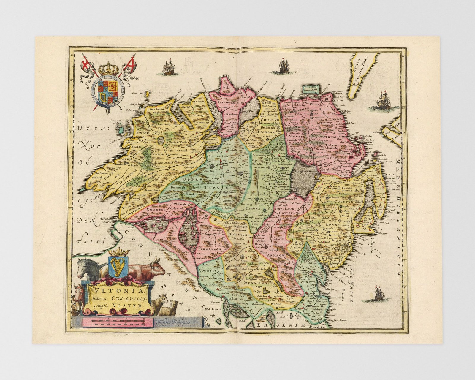
Transport yourself to seventeenth-century Northern Ireland through our remarkable collection of antique maps. Explore the enchanting streets of Belfast, the capital city, where a blend of Victorian and Edwardian architecture reflects the region’s rich industrial heritage. Journey through the rugged landscapes of the Giant’s Causeway, a UNESCO World Heritage Site, with its iconic hexagonal basalt columns formed by volcanic activity. Uncover the ancient ruins of Dunluce Castle and the historic walled city of Derry/Londonderry, each bearing witness to Northern Ireland’s turbulent past. These antique maps offer a glimpse into the unique blend of natural beauty, cultural heritage, and historical significance that defined Northern Ireland during the seventeenth century. Embark on a visual odyssey and let these cartographic treasures guide you through the captivating stories and scenic wonders of this extraordinary land.
Top rated products
Showing the single result